
































met meer dan 200.000 artikelen
voordelig
met geld terug-garantie
in 1A-kwaliteit
krijgen
Artikeldetails
Automatische vertaling
Originele tekst in English
Garmin zūmo® XT3 4.7-Zoll, navigatiesysteem
Art.-nr.: 11101593
Rijden op een motor is echt een speciale sensatie. Met de zūmo XT3 is je rit nog beter geworden—van de open weg tot het circuit. Deze motorfiets-GPS is IPX7 waterdicht en voldoet aan MIL-STD-810 normen, dus hij is bestand tegen extreme weersomstandigheden en stuurtrillingen.
Functies
- 4,7-inch touchscreen
- Bestand tegen weersinvloeden en trillingen
- Gedetailleerde wegenkaarten en topografische kaarten
- Gedetailleerde satellietbeelden
- Gegevens over hellingshoek, G-kracht, maximale snelheid en nog veel meer
- Gedetailleerde analyse van ritgegevens via de Tread® app
- Garmin Avontuurlijke Routing™
- waarschuwingen voor gevaarlijke locaties
- Ongevallenmelding aan vooraf aangewezen contactpersonen
- Grote Ritten database: ontdek populaire motorroutes en synchroniseer favorieten
- Bluetooth voor muziek, telefoon en navigatie via headset
- Pairing met smartphone mogelijk via de Tread® app³
- Toegang tot real-time verkeersgegevens en weerberichten
- Verbindbaar met smartphone via headset
- Geïntegreerde Wi-Fi-technologie
- Groepsritfuncties
Technische specificaties
- Diagonaal: 4,7 inch (11,8 cm)
- Display resolutie: 1280 × 720 px
- Displaygrootte: 10,3 × 5,8 cm
- Waterbestendigheid: IPX7
- Druppelbestendigheid: MIL-STD-810
- Intern geheugen: 64 GB
- Externe opslag uitbreidbaar via microSD™ kaart (niet meegeleverd)
- Aanmelding voor het Garmin Performance Package™ afzonderlijk verkrijgbaar
Wat’s in de doos
- Garmin zūmo® XT3 4,7-inch navigatiesysteem voor motorfietsen
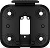
- Stuurbevestigingsset
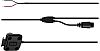
- Oplaad-/datakabel
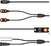
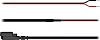
- Voedingskabel
- Documentatie
Ritgegevens
Bekijk je hellingshoeken, G-krachten, topsnelheid en andere gegevens in je ritoverzicht en deel ze via de Tread® app.
Groepsritfuncties
Gebruik de Tread® app op je smartphone en/of je zūmo XT3 om vrienden te volgen met de Group Ride Mobile functie¹ (mobiele service vereist). Gebruik de Group Ride Tracker accessoire² samen met de Group Ride Tracker Y-adapter (beide apart verkrijgbaar) wanneer je in gebieden rijdt zonder mobiele dekking. Hiermee kun je andere rijders volgen die ook een compatibel zūmo® of Tread® apparaat gebruiken.
Nog meer routes
Ontdek nieuwe routes met de Great Rides functie in de Tread® app en markeer ze als favoriet om ze automatisch te synchroniseren met je apparaat. Je kunt ook moeilijkheidsgraden toevoegen en foto's uploaden om ze met andere rijders te delen.
Visuele routeplanner
Plan een route direct op de navigator of gebruik de Tread® app op een compatibele smartphone. Selecteer specifieke kenmerken zoals bochten, hellingen of schilderachtige achterafweggetjes. Je kunt ook je eigen routes importeren als GPX-, KML- of KMZ-bestanden.
Sleeprace Timer
Volg je acceleratie van 0 tot 100 km/u (0–60 mph) en je tijden voor de 1/8 mijl en 1/4 mijl—met een actief Garmin Prestatie Pakket.
Rondetijdenoverzicht
Bekijk je rondetijden, racemetriek, delta tijden, hellingshoeken in elke bocht en nog veel meer—met een actief Garmin Performance Package.
Populaire routes
Ontdek populaire motorroutes van andere rijders om nieuwe en spannende routes voor je tochten te vinden.
Garmin avontuurlijke routes
Keine wegen zijn saai. Vind de spannendste routes met bergen, bochten en bezienswaardigheden en kies uit vier verschillende moeilijkheidsgraden.
Satellietbeelden
Satellietbeelden met hoge resolutie bieden gedetailleerde vogelvluchtbeelden van je route en het omliggende terrein om het navigeren te vergemakkelijken. Download kaarten direct op je apparaat via Wi-Fi—geen abonnement nodig.
Muziek en routebeschrijving
Houd je headset gekoppeld aan je smartphone om je muziek te bedienen of stapsgewijze aanwijzingen te ontvangen van je apparaat. Navigatie-aanwijzingen worden via uw smartphone naar uw headset doorgestuurd.
Verkeer en Weer
Krijg toegang tot realtime verkeersgegevens en weerberichten, deel routes met andere rijders en ontvang smartphone-meldingen via de Tread® app³.
Buitenkaarten+
Met een actief Outdoor Maps+ abonnement krijg je permanent toegang tot een breed scala aan premium kaartcontent. Dit omvat “Adventure Roads & Trails” voor nauwkeurige routebegeleiding tijdens je off-road avonturen. De inhoud wordt regelmatig bijgewerkt en rechtstreeks naar je navigatiesysteem overgebracht.
Michelin® Scenic Routes
Ontdek onvergetelijke tochten met MICHELIN® Scenic Routes. Integreer ze eenvoudig in uw reis via de routeplanner of neem ze mee op een spontane rit door de groen gemarkeerde route direct op de kaart te selecteren.
Track Recorder
Reg je ritgegevens op—inclusief snelheid, afstand, hellingshoeken, versnelling en meer—en deel de details met vrienden in de Tread® app.
Beheer je gegevens
Makkelijk tracks en routes beheren³ via de Tread® app op je navigatiesysteem en compatibele smartphone.
Rijderswaarschuwingen
ontvang waarschuwingen voor gevaren langs je route, zoals scherpe bochten, snelheidswijzigingen en nog veel meer.
Ongevallenmeldingen
Als er een ongeluk wordt gedetecteerd, wordt er automatisch een sms met uw locatiegegevens naar uw vooraf aangewezen contactpersoon³ gestuurd.
Hindernisbewaking
Koppel het navigatiesysteem met het zūmo™ R1 Radar Systeem (apart verkrijgbaar) om je achteruitkijk- en dode hoeken te bewaken. De externe verlichting maakt je beter zichtbaar voor anderen op de weg, en het systeem kan voertuigen om je heen direct op de navigator weergeven.
Hendelbediening
Controleer de kaart met één druk op de knop en houd uw handen aan het stuur tijdens het rijden—als u uw navigator koppelt met de bedrade stuurcontroller (apart verkrijgbaar).
Off-grid communicatie
Koppel uw navigator met een inReach® satellietcommunicatie-apparaat⁴ (apart verkrijgbaar) als u in afgelegen gebieden zonder mobiele dekking reist. Hiermee kunt u berichten in twee richtingen versturen, uw locatie delen en een interactief SOS-alarm activeren in geval van nood.
Off-the-grid ritten
Ga op verkenning zonder vast te zitten. Navigeer eenvoudig met behulp van een kompas met een pijl die afstand en richting naar je bestemming aangeeft.
Draadloze updates
Dankzij de ingebouwde Wi-Fi-connectiviteit⁵ is het eenvoudig om je kaarten en software up-to-date te houden zonder computer. Notities op het scherm laten je weten wanneer er nieuwe updates beschikbaar zijn.
Aantekeningen
- 1 Voor het mobiel volgen van groepsritten moet de Tread app actief zijn op jouw compatibele smartphone en op de smartphones van je vrienden’ die compatibel zijn. De smartphones moeten Bluetooth® technologie ondersteunen en een actieve mobiele verbinding hebben.
- 2 Het is aanbevolen dat de Tread app draait op jouw compatibele zūmo of Tread apparaat. Voor de groepsritfunctie en het gebruik van de PTT-microfoon, moet het apparaat verbonden zijn met de voeding van het voertuig. Koppel de zūmo XT3 met je helm of headset (niet meegeleverd) via Bluetooth technologie om handsfree te communiceren. Voor zūmo XT3 producten heb je ook de Group Ride Tracker Y-adapter nodig (apart verkrijgbaar).
- 3 De zūmo moet gekoppeld zijn aan je smartphone met Bluetooth en GPS technologie, waarop de Tread app draait.
- 4 Actief satellietabonnement vereist. In sommige rechtsgebieden is het gebruik van satellietcommunicatieapparatuur bij wet geregeld of verboden. Het is de verantwoordelijkheid van de gebruiker’s om zich bewust te zijn van en te voldoen aan alle toepasselijke wetten in de rechtsgebieden waar het product gebruikt gaat worden.
- 5 Actieve verbinding met Wi-Fi-connectiviteit vereist.
Garmin zūmo® XT3 4.7-Zoll, navigation system
Article No.: 11101593
Riding a motorcycle is a truly special thrill. With the zūmo XT3, your ride just got even better—from the open road to the racetrack. This motorcycle GPS is IPX7 waterproof and meets MIL-STD-810 standards, so it can withstand extreme weather conditions and handlebar vibrations.
Features
- 4.7-inch touchscreen
- Withstands weather and vibrations
- Detailed road and topographic maps
- Detailed satellite imagery
- Displays lean angle, G-force, max. speed, and much more
- Detailed ride data analysis via the Tread® app
- Garmin Adventurous Routing™
- Warnings for hazardous locations
- Accident notification to pre-designated contacts
- Great Rides database: discover popular motorcycle routes and sync favorites
- Bluetooth for music, phone, and navigation via headset
- Pairing with smartphone possible via the Tread® app³
- Access to real-time traffic data and weather reports
- Connectable to smartphone via headset
- Integrated Wi-Fi technology
- Group Ride features
Technical Specifications
- Diagonal: 4.7 inches (11.8 cm)
- Display resolution: 1280 × 720 px
- Display size: 10.3 × 5.8 cm
- Water resistance: IPX7
- Drop resistance: MIL-STD-810
- Internal storage: 64 GB
- External storage expandable via microSD™ card (not included)
- Subscription to the Garmin Performance Package™ available separately
What’s in the box
- Garmin zūmo® XT3 4.7-inch motorcycle navigation device
- Handlebar mount kit
- Charging/data cable
- Power cable
- Documentation
Ride metrics
View your lean angles, G-forces, top speed, and other data in your ride summary and share it via the Tread® app.
Group Ride Features
Use the Tread® app on your smartphone and/or your zūmo XT3 to track friends with the Group Ride Mobile feature¹ (cell service required). Use the Group Ride Tracker accessory² along with the Group Ride Tracker Y-adapter (both sold separately) when riding in areas without cellular coverage. This allows you to track other riders who are also using a compatible zūmo® or Tread® device.
Even More Routes
Discover new routes with the Great Rides feature in the Tread® app and mark them as favorites to automatically sync them with your device. You can also add difficulty ratings and upload photos to share them with other riders.
Visual Route Planner
Plan a custom route directly on the navigator or use the Tread® app on a compatible smartphone. Select specific features such as curves, inclines, or scenic backroads. You can also import your own routes as GPX, KML, or KMZ files.
Drag Race Timer
Track your acceleration from 0 to 100 km/h (0–60 mph) as well as your times for the 1/8-mile and 1/4-mile—with an active Garmin Performance Package.
Lap Time Overview
View your lap times, race metrics, delta times, lean angles in every corner, and much more—with an active Garmin Performance Package.
Popular Routes
Discover popular motorcycle routes from other riders to find new and exciting routes for your tours.
Garmin Adventurous Routing
Straight roads are boring. Find the most exciting routes featuring mountains, curves, and points of interest, choosing from four different difficulty levels.
Satellite Images
High-resolution satellite images provide detailed bird’s-eye views of your route and the surrounding terrain to make navigation easier. Download maps directly to your device via Wi-Fi—no subscription required.
Music and Turn-by-Turn Directions
Keep your headset paired with your smartphone to control your music or receive turn-by-turn directions from your device. Navigation prompts are relayed to your headset via your smartphone.
Traffic and Weather
Get access to real-time traffic data and weather reports, share routes with other riders, and receive smartphone notifications via the Tread® app³.
Outdoor Maps+
With an active Outdoor Maps+ subscription, you get permanent access to a wide range of premium map content. This includes “Adventure Roads & Trails” for precise route guidance on your off-road adventures. The content is updated regularly and transferred directly to your navigation system.
Michelin® Scenic Routes
Discover unforgettable tours with MICHELIN® Scenic Routes. Easily integrate them into your trip via the route planner or take them on a spontaneous ride by selecting the green-marked route directly on the map.
Track Recorder
Record your ride data—including speed, distance, lean angles, acceleration, and more—and share the details with friends in the Tread® app.
Manage Your Data
Easily manage tracks and routes³ via the Tread® app on your navigation device and compatible smartphone.
Driver Alerts
Receive alerts for hazards along your route, such as sharp curves, speed changes, and much more.
Accident notifications
If an accident is detected, a text message with your location information is automatically sent to your pre-designated contact³.
Blind spot monitoring
Pair the navigation device with the zūmo™ R1 Radar System (sold separately) to monitor your rear view and blind spots. The external lights make you more visible to others on the road, and the system can display vehicles around you directly on the navigator.
Handlebar Controller
Control the map conveniently at the touch of a button and keep your hands on the handlebars while driving—when you pair your navigator with the wired handlebar controller (sold separately).
Off-grid communication
Pair your navigator with an inReach® satellite communication device⁴ (sold separately) when traveling in remote areas without cellular coverage. This lets you send two-way messages, share your location, and trigger an interactive SOS emergency alert in case of an emergency.
Off-the-grid rides
Go exploring without being tied down. Navigate easily using a compass with an arrow that shows distance and direction to your destination.
Wireless updates
Thanks to built-in Wi-Fi connectivity⁵, it’s easy to keep your maps and software up to date without a computer. On-screen notes let you know when new updates are available.
Notes
- 1 For Group Ride mobile tracking, the Tread app must be running on your compatible smartphone as well as on your friends’ compatible smartphones. The smartphones must support Bluetooth® technology and have an active cellular connection.
- 2 It is recommended that the Tread app be running on your compatible zūmo or Tread device. For the Group Ride feature and use of the PTT microphone, the device must be connected to the vehicle’s power supply. Pair the zūmo XT3 with your helmet or headset (not included) using Bluetooth technology to communicate via hands-free. zūmo XT3 products also require the Group Ride Tracker Y-adapter (sold separately).
- 3 The zūmo must be paired with your smartphone equipped with Bluetooth and GPS technology, on which the Tread app is running.
- 4 Active satellite subscription required. In some jurisdictions, it is recommended that the use of satellite communication devices be regulated or prohibited by law. It is the user’s responsibility to be aware of and comply with all applicable laws in the jurisdictions where the product is to be used.
- 5 Active connection with Wi-Fi connectivity required.
Klantenreviews
Hebt u ervaring met het artikel?