
































avec plus de 200.000 articles
à un prix avantageux
avec garantie de remboursement
service à la clientèle
Cadeaux gratuits
Détails de l'article
Traduction automatique
Texte original in English
Garmin zūmo® XT3 6-inch, système de navigation
Réf. : 11101592
Moto XT3 est un GPS pour moto.
Caractéristiques
- Écran tactile de 6 pouces
- Résiste aux intempéries et aux vibrations
- Cartes routières et topographiques détaillées
- Imagerie satellite détaillée
- Affiche l'angle d'inclinaison, la force G, la vitesse maximale et bien plus encore
- Analyse détaillée des données de conduite via l'application Tread®
- Garmin Adventurous Routing™
- Avertissements pour les zones dangereuses
- Notification d'accident aux contacts pré-désignés
- Base de données Great Rides : découvrez les itinéraires moto les plus populaires et synchronisez vos favoris
- Bluetooth pour la musique, le téléphone et la navigation via un casque
- Peut être couplé à un smartphone via l'application Tread® ; App³
- Accès aux données de trafic en temps réel et aux bulletins météorologiques
- Peut être connecté à un smartphone via un casque
- Technologie Wi-Fi intégrée
- Fonctionnalités de conduite en groupe
Spécifications techniques
- Diagonale : 6 pouces (15,3 cm)
- Résolution d'affichage : 1280 × ; 720 px
- Taille de l'écran : 13,3 fois ; 7,5 cm
- Résistance à l'eau : IPX7
- Résistance aux chutes : MIL-STD-810
- Stockage interne : 64 Go
- Stockage externe extensible via carte microSD&trade ; (non incluse)
- Souscription au Garmin Performance Package&trade ; disponible séparément
Ce que contient la boîte
- Garmin zūmo® ; XT3 6-inch motorcycle navigation device
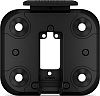
- Kit de montage sur le guidon
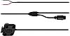
- Câble de chargement/données
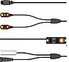
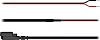
- Câble d'alimentation
- Documentation
Ride Dynamics
Visualisez vos angles d'inclinaison, vos forces G, votre vitesse maximale et d'autres données dans votre résumé de conduite et partagez-les via l'application Tread® ;
.
Fonctionnalités de conduite en groupe
Encore plus d'itinéraires
Découvrez de nouveaux itinéraires grâce à la fonction Great Rides de l'application Tread® ; et marquez-les comme favoris pour les synchroniser automatiquement avec votre appareil. Vous pouvez également ajouter des notes de difficulté et télécharger des photos pour les partager avec d'autres cyclistes.
Planificateur d'itinéraire visuel
Planifiez un itinéraire personnalisé directement sur le navigateur ou utilisez l'application Tread® ; sur un smartphone compatible. Sélectionnez des caractéristiques spécifiques telles que des courbes, des pentes ou des routes secondaires pittoresques. Vous pouvez également importer vos propres itinéraires sous forme de fichiers GPX, KML ou KMZ.
Chronomètre de course à pied
Découvrez les itinéraires de moto populaires d'autres pilotes pour trouver de nouveaux itinéraires passionnants pour vos randonnées.
Routes aventureuses Garmin
Les routes droites sont ennuyeuses. Trouvez les itinéraires les plus passionnants avec des montagnes, des virages et des points d'intérêt, en choisissant parmi quatre niveaux de difficulté différents.
Images satellites
Musique et instructions détaillées
Maintenez votre casque couplé à votre smartphone pour contrôler votre musique ou recevoir des indications virage par virage de votre GPS. Les instructions de navigation sont transmises à votre oreillette par l'intermédiaire de votre smartphone.
Trafic et météo
Accédez aux données de trafic et aux bulletins météo en temps réel, partagez vos itinéraires avec d'autres cyclistes et recevez des notifications sur votre smartphone via l'application Tread® ; app³ ;.
Les données de trafic et la météo sont transmises à votre casque via votre smartphone.
Cartes extérieures+
Avec un abonnement Outdoor Maps+ actif, vous bénéficiez d'un accès permanent à un large éventail de contenu cartographique premium. Cela inclut “Adventure Roads & ; Trails&rdquo ; pour un guidage routier précis lors de vos aventures tout-terrain. Le contenu est mis à jour régulièrement et transféré directement sur votre système de navigation.
Michelin® ; Scenic Routes
Découvrez des circuits inoubliables avec MICHELIN® ; Scenic Routes. Intégrez-les facilement à votre voyage via le calculateur d'itinéraires ou partez en balade spontanée en sélectionnant l'itinéraire marqué en vert directement sur la carte.
Les routes panoramiques MICHELIN® ; Scenic Routes
Enregistreur de traces
Enregistrez vos données de conduite—y compris la vitesse, la distance, les angles d'inclinaison, l'accélération, et plus encore—et partagez les détails avec vos amis dans l'application Tread® ;.
Les données de conduite sont enregistrées dans l'application Tread® ;.
Gérez vos données
Gérez facilement vos pistes et itinéraires³ ; via l'application Tread® ; sur votre appareil de navigation et votre smartphone compatible.
La gestion de vos données est un jeu d'enfant.
Alertes du conducteur
Recevez des alertes en cas de danger sur votre itinéraire, comme les virages serrés, les changements de vitesse, et bien plus encore.
L'application Tread®3 ; sur l'appareil de navigation et le smartphone compatible.
Notifications d'accident
Si un accident est détecté, un message texte contenant les informations relatives à votre position est automatiquement envoyé à votre contact pré-désigné³ ;.
Les alertes d'accident sont envoyées à votre contact pré-désigné.
Surveillance des angles morts
Associez l'appareil de navigation au zūmo&trade ; R1 Radar System (vendu séparément) pour surveiller votre vue arrière et vos angles morts. Les feux extérieurs vous rendent plus visible pour les autres sur la route, et le système peut afficher les véhicules autour de vous directement sur le navigateur.
Commande au guidon
Contrôlez la carte en appuyant sur un bouton et gardez les mains sur le guidon pendant que vous conduisez—lorsque vous associez votre navigateur au contrôleur de guidon câblé (vendu séparément).La fonction de contrôle du guidon vous permet de contrôler la carte en appuyant sur un bouton et de garder les mains sur le guidon pendant que vous conduisez.
Communication hors réseau
Jumelez votre navigateur avec un dispositif de communication par satellite inReach®⁴ (vendu séparément) lorsque vous voyagez dans des zones éloignées sans couverture cellulaire. Cela vous permet d'envoyer des messages bidirectionnels, de partager votre position et de déclencher une alerte SOS interactive en cas d'urgence.
Randonnées hors réseau
Partez à la découverte sans être attaché. Naviguez facilement à l'aide d'une boussole dotée d'une flèche qui indique la distance et la direction à suivre pour atteindre votre destination.
La navigation hors réseau est un jeu d'enfant.
Mises à jour sans fil
Mise à jour sans fil
Notes
- 1 Pour le suivi mobile des randonnées en groupe, l'application Tread doit être en cours d'exécution sur votre smartphone compatible ainsi que sur les smartphones compatibles de vos amis. Les smartphones doivent supporter la technologie Bluetooth® ; et avoir une connexion cellulaire active.
- 2 Il est recommandé d'utiliser un zūmo ou un appareil Tread compatible et l'application Tread. Pour la fonction de conduite en groupe et l'utilisation du microphone PTT, l'appareil doit être connecté à l'alimentation du véhicule. Associez le zūmo XT3 à votre casque ou écouteur compatible Bluetooth (non inclus) pour communiquer en mains libres. Les produits zūmo XT3 nécessitent également l'adaptateur en Y Group Ride Tracker (vendu séparément).
- 3 Le zūmo doit être couplé à votre smartphone compatible Bluetooth et GPS exécutant l'application Tread.
- 4 Abonnement satellite actif requis. Dans certaines juridictions, il est recommandé que l'utilisation d'appareils de communication par satellite soit réglementée ou interdite par la loi. Il est de la responsabilité de l’utilisateur de connaître et de respecter toutes les lois applicables dans les juridictions où le produit doit être utilisé.
- 5 Connexion active avec connectivité Wi-Fi requise.
Garmin zūmo® XT3 6-inch, navigation system
Article No.: 11101592
Riding a motorcycle is a truly special thrill. With the zūmo XT3, your ride just got even better—from the open road to the racetrack. This motorcycle GPS is IPX7 waterproof and meets MIL-STD-810 standards, so it can withstand extreme weather conditions and handlebar vibrations.
Features
- 6-inch touchscreen
- Withstands weather and vibrations
- Detailed road and topographic maps
- Detailed satellite imagery
- Displays lean angle, G-force, max. speed, and much more
- Detailed ride data analysis via the Tread® app
- Garmin Adventurous Routing™
- Warnings for hazardous areas
- Accident notification to pre-designated contacts
- Great Rides database: discover popular motorcycle routes and sync favorites
- Bluetooth for music, phone, and navigation via headset
- Can be paired with a smartphone via the Tread® App³
- Access to real-time traffic data and weather reports
- Can be connected to a smartphone via headset
- Integrated Wi-Fi technology
- Group Ride features
Technical specifications
- Diagonal: 6 inches (15.3 cm)
- Display resolution: 1280 × 720 px
- Display size: 13.3 × 7.5 cm
- Water resistance: IPX7
- Drop resistance: MIL-STD-810
- Internal storage: 64 GB
- External storage expandable via microSD™ card (not included)
- Subscription to the Garmin Performance Package™ available separately
What’s in the box
- Garmin zūmo® XT3 6-inch motorcycle navigation device
- Handlebar mount kit
- Charging/data cable
- Power cable
- Documentation
Ride Dynamics
View your lean angles, G-forces, top speed, and other data in your ride summary and share it via the Tread® app.
Group Ride Features
Use the Tread® app on your smartphone and/or your zūmo XT3 to track friends with the Group Ride Mobile feature¹ (cell service required). Use the Group Ride Tracker accessory² along with the Group Ride Tracker Y-adapter (both sold separately) when riding in areas without cell service. This lets you track other riders who are also using a compatible zūmo® or Tread® device.
Even More Routes
Discover new routes with the Great Rides feature in the Tread® app and mark them as favorites to automatically sync them with your device. You can also add difficulty ratings and upload photos to share them with other riders.
Visual Route Planner
Plan a custom route directly on the navigator or use the Tread® app on a compatible smartphone. Select specific features such as curves, inclines, or scenic side roads. You can also import your own routes as GPX, KML, or KMZ files.
Drag Race Timer
Track your acceleration from 0 to 100 km/h (0–60 mph) as well as your times for the 1/8-mile and 1/4-mile—with an active Garmin Performance Package.
Lap Time Overview
View your lap times, race metrics, delta times, lean angles in every corner, and much more—with an active Garmin Performance Package.
Popular Routes
Discover popular motorcycle routes from other riders to find new and exciting routes for your tours.
Garmin Adventurous Routing
Straight roads are boring. Find the most exciting routes featuring mountains, curves, and points of interest, choosing from four different difficulty levels.
Satellite Images
High-resolution satellite images provide detailed bird’s-eye views of your route and the surrounding terrain to make navigation easier. Download maps directly to your GPS using Wi-Fi—no subscription required.
Music and Turn-by-Turn Directions
Keep your headset paired with your smartphone to control your music or receive turn-by-turn directions from your GPS. Navigation prompts are relayed to your headset via your smartphone.
Traffic and Weather
Get access to real-time traffic data and weather reports, share routes with other riders, and receive smartphone notifications via the Tread® app³.
Outdoor Maps+
With an active Outdoor Maps+ subscription, you get permanent access to a wide range of premium map content. This includes “Adventure Roads & Trails” for precise route guidance on your off-road adventures. The content is updated regularly and transferred directly to your navigation system.
Michelin® Scenic Routes
Discover unforgettable tours with MICHELIN® Scenic Routes. Easily integrate them into your trip via the route planner or take them on a spontaneous ride by selecting the green-marked route directly on the map.
Track Recorder
Record your ride data—including speed, distance, lean angles, acceleration, and more—and share the details with friends in the Tread® app.
Manage Your Data
Easily manage tracks and routes³ via the Tread® app on your navigation device and compatible smartphone.
Driver Alerts
Receive alerts for hazards along your route, such as sharp curves, speed changes, and much more.
Accident notifications
If an accident is detected, a text message with your location information is automatically sent to your pre-designated contact³.
Blind spot monitoring
Pair the navigation device with the zūmo™ R1 Radar System (sold separately) to monitor your rear view and blind spots. The external lights make you more visible to others on the road, and the system can display vehicles around you directly on the navigator.
Handlebar Controller
Control the map with the push of a button and keep your hands on the handlebars while driving—when you pair your navigator with the wired handlebar controller (sold separately).
Off-Grid Communication
Pair your navigator with an inReach® satellite communication device⁴ (sold separately) when traveling in remote areas without cellular coverage. This allows you to send two-way messages, share your location, and trigger an interactive SOS emergency alert in case of an emergency.
Off-the-grid rides
Go exploring without being tied down. Navigate easily using a compass with an arrow that shows the distance and direction to your destination.
Wireless updates
Thanks to built-in Wi-Fi connectivity⁵, it’s easy to keep your maps and software up to date without a computer. On-screen notes let you know when new updates are available.
Notes
- 1 For mobile Group Ride tracking, the Tread app must be running on your compatible smartphone as well as on your friends’ compatible smartphones. The smartphones must support Bluetooth® technology and have an active cellular connection.
- 2 It is recommended that a compatible zūmo or Tread device and the Tread app be used. For the Group Ride feature and use of the PTT microphone, the device must be connected to the vehicle’s power supply. Pair the zūmo XT3 with your Bluetooth-enabled helmet or headset (not included) to communicate via hands-free. zūmo XT3 products also require the Group Ride Tracker Y-adapter (sold separately).
- 3 The zūmo must be paired with your Bluetooth- and GPS-enabled smartphone running the Tread app.
- 4 Active satellite subscription required. In some jurisdictions, it is recommended that the use of satellite communication devices be regulated or prohibited by law. It is the user’s responsibility to be aware of and comply with all applicable laws in the jurisdictions where the product is to be used.
- 5 Active connection with Wi-Fi connectivity required.
Avis des clients
As-tu expérimenté l\'article?